Planet Explorer is a web application from Planet.com that allows you to search for and view geospatial imagery.
It captures images from a fleet of satellites and offers a variety of tools to view and compare geospatial images.
In this review post, I will compare the different features of Planet Explorer. This will help you understand how you can use it for research and educational purposes and more!
Let’s get into it.
Verdict
Our Rating: ⭐⭐⭐⭐✰
Planet Explorer is a web application offered by Planet.com, which provides geospatial imagery, satellite monitoring, and mapping services to organizations and governments.
It’s not as useful for individuals, but if you want to perform advanced analysis using satellite imagery, it is very helpful.
Pros
- It has a fleet of hundreds of satellites that cover all parts of the globe.
- You can perform advanced analysis.
- You can use it for forest monitoring, farming, maritime monitoring, and many other use cases.
Cons
- It’s geared towards large organizations (both nonprofits and corporations) and governmental agencies rather than individuals, although individuals can derive some benefits for research purposes.
- It is expensive.
- It has a large learning curve.
What Is Planet Explorer?
Planet.com provides solutions for the forestry, agriculture, energy, oil, and other industries, as well as local and national governments, including militaries.
You can also use it for research purposes.
Planet Explorer Features
Let’s talk about the different features and products available from Planet Explorer.
Satellite Images
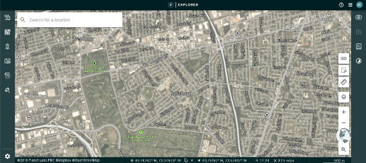
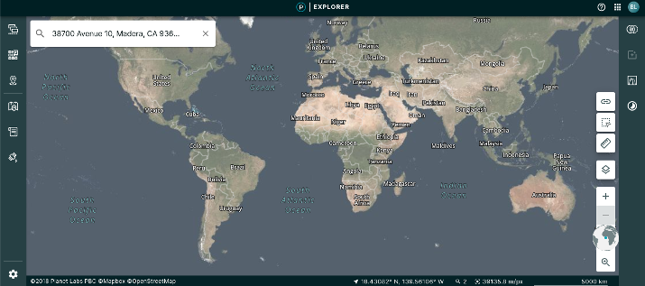
Planet Explorer allows you to explore the world via satellite images. You can move the map to a location or enter it into the search bar.
You can then view a satellite map and zoom in to get additional details, such as street names. It’s easy to see terrain details, roads, and more.
Areas of Interest
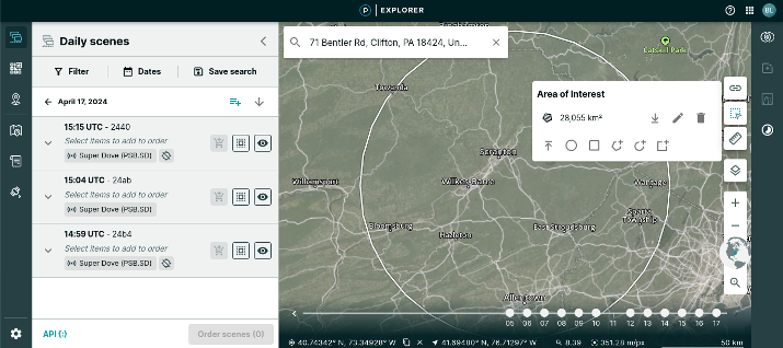
Planet Explorer is particularly useful for analyzing specific areas. Using the tool on the right side of the screen, you can draw an area of interest you wish to analyze.
Various shapes are available, and you can also draw a custom shape around your area of interest.
As you can see in the screenshot above, I have created a circle around Scranton, Pennsylvania.
Once you specify an area of interest, things start to get exciting. You can start exploring “scenes” from that area of interest.
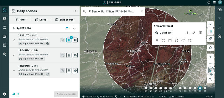
Scenes are just geospatial images captured by satellites. Exactly which satellite system the images are from will be specified; it’s usually PlanetScope or SkySat.
Typically, there will be multiple scenes for any given day. You can browse all the scenes available from that date or filter for specific scenes, such as those captured in high resolution only.
You can then order scenes for analysis. There are various types of analysis you can run.
You can take measurements, for example, and measure distances between places. We will talk more about how to compare data in the subsequent sections of this article.
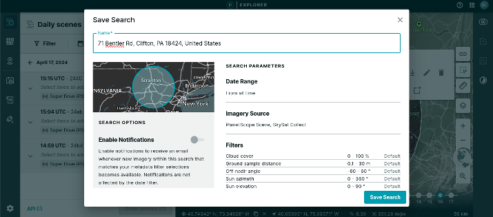
You can always save a search so you can go back to it at a later date.
When saving a search, you can specify filters for notifications. When new images become available for your area of interest, you will get an email notification.
You can also create folders and organize your saved searches in folders.
Comparing Imagery
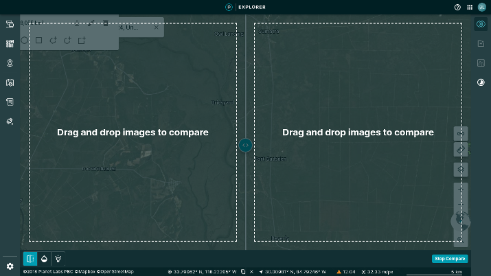
One of the best ways to analyze satellite images on Planet Explorer is to compare two scenes side by side.
These scenes can be taken from separate satellites or at different time points. The side by side comparison tool allows you to quickly see how the images from two satellites differ or which changes have occurred throughout the day you are analyzing the data for.
Once you select two scenes to analyze, you will be able to view them side by side. You can also compare opacity and relative luminance side by side.
Performing Spectral Analysis
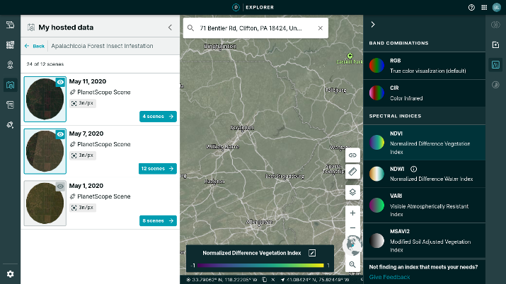
When viewing your hosted data, you can perform spectral analysis of an area. For example, you can perform true color visualization with RGB (Red, Green, Blue) colors or perform a color infrared analysis.
You can also perform a spectral analysis using NDVI (Normalized Difference Vegetation Index), NDWI (Normalized Difference Water Index), VARI (Visible Atmospherically Resistant Index), and more.
High-Resolution Images
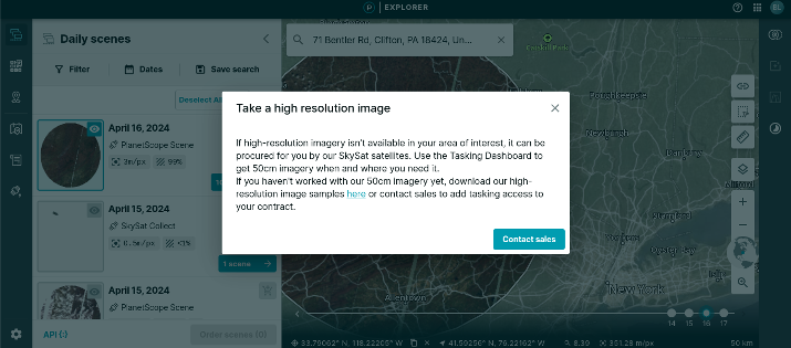
You can also order high-resolution images of your area of interest if you have a paid plan. These high-resolution images provide high-resolution snapshots of the areas you are researching.
They range from 50 cm to 80 cm in resolution.
Creating Time Lapse Stories
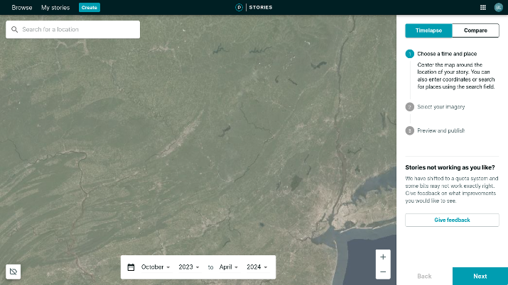
You can also create time-lapse animations in Planet Explorer. To do that, click on the Time Lapse option on the right side of your screen (it looks like a circle with a half moon inside it).
Start by selecting a place you want to create a time-lapse for. Then, select the start and end times at the bottom of the screen.
You can then add the imagery you would like to use for your time-lapse.
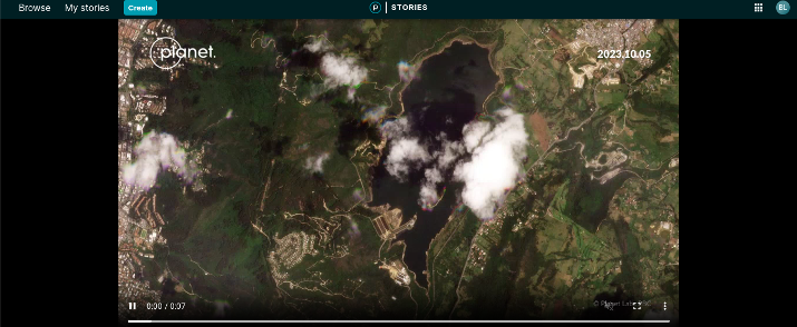
Time-Lapse Stories
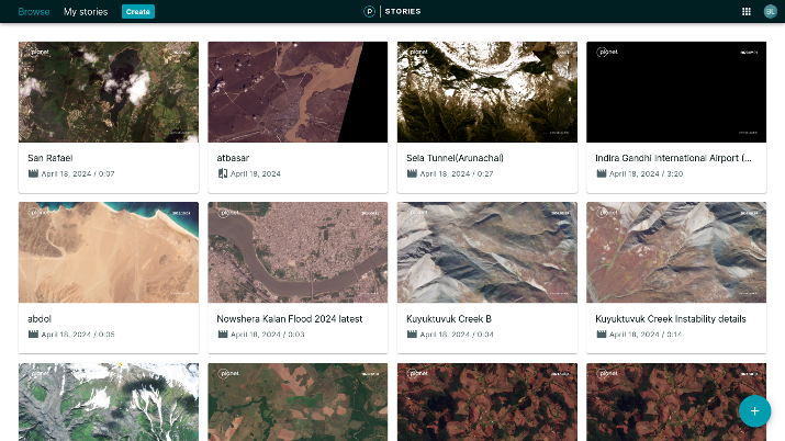
There are various stories in the Stories database, which you can browse and view. These are just time-lapses created by others.
For example, as you can see in the screenshot above, you can see a time-lapse for San Rafael on April 18, 2024. The stories you will see towards the top are the most recent ones.
If you’re interested in seeing what is happening around the world from the view of satellites, you can check the Stories database regularly. It’s pretty interesting.
Who Is Planet Explorer For?
Planet Explorer isn’t useful if you simply want to view weather or satellite maps. It requires quite a bit of a learning curve and is best for organizations, nonprofits, governmental agencies, or individuals conducting in-depth research.
It is not free to use. You do get access to a two-week trial, during which you can access Planet Explorer, but you still need a plan to order high-resolution images and other tasking services.
There are quotas for using base maps and analyzing data. For example, if you select large areas of interest, you will use up your quotas faster.
You can always top up your quotas when they run out, but as you can see, it’s not meant for a hobbyist but for an organization with the financial means for it.
So, Planet Explorer is meant for larger scale organizations.
For example, Planet Explorer is perfect for environmental organizations.
Forest owners can monitor forests, and farmers can optimize harvest while conducting automated analysis of their lands. Obviously, we’re talking about large farming industries here and not farmers with small farms, who wouldn’t need such advanced solutions.
In one case study, Pan Pac Forests in New Zealand used cutover mapping with high-frequency satellite imagery to improve data accuracy and save time and costs.
For timber harvesting, for example, Planet Explorer’s mapping software can help you estimate how much timber you will be able to harvest over a given period.
Planet Explorer can also be used to map the effects of natural disasters or to detect the risks of future natural disasters and their potential impacts. It can also be used to conduct analysis to mitigate such risks.
In addition, it can be used to regularly monitor forests for spread of disease and overall tree health.
Not only that, but areas of deforestation can be pinpointed and addressed. Illegal deforestation can occur anywhere, and governmental organizations tasked with combating it can detect it early on, with the help of Planet Explorer, by analyzing historical trends.
Planet.com can help armed forces reduce operational risk by analyzing activity and issues in other countries and in maritime areas, improving response times.
It can help governments reduce on-site inspections, identify problems in strategic or protected areas, and support natural resource management and disaster management.
Is Planet Explorer Difficult to Use?
Planet Explorer has quite a learning curve involved, so much so that Planet.com dedicated a course to teaching you how to use it.
This course is part of Planet University, which is a series of courses from Planet.com covering how to use its tools most efficiently.
Pricing
Planet.com is not transparent about pricing. You need to contact support to learn about pricing.
You can start a free trial, during which you can use the basic tools of Planet Explorer, although you won’t be able to use the tasking dashboard and order tasks, like high-resolution images.
For that, you will need to request a subscription plan. Note that your plan will have quotas, so you will need to top up as necessary.
Conclusion
Planet Explorer is a useful tool for researchers, governments, armies, environmental organizations (such as non-profits), farmers, forest owners, oil and gas companies, and other large organizations.
It has a lot of useful tools, but it is not cheap. In addition, it is not the most user-friendly tool.
It has a lot of features that can be challenging to figure out, although Planet University courses can help you learn how to use the different tools. Pricing is also not clear and transparent upfront.
Tom loves to write on technology, e-commerce & internet marketing. I started my first e-commerce company in college, designing and selling t-shirts for my campus bar crawl using print-on-demand. Having successfully established multiple 6 & 7-figure e-commerce businesses (in women’s fashion and hiking gear), I think I can share a tip or 2 to help you succeed.